

Introduction
Automated vehicles are increasingly present in modern society. Already, prototype cars have been automated and judged reliable enough to drive autonomously under standard driving conditions. Beyond cars, there is a diversity of vehicles suitable for automation and across vehicle type there are common guidelines identified to standardize the process of making an autonomous vehicle. In this article, we review what the common factors are and illustrate with some examples of automated ground vehicles developed with Freelance Robotics Pty Ltd.
Automated cars
The DARPA Urban challenge did provide an incentive in the quest towards a fully automated car. DARPA has been directly linked to the successful development of autonomous vehicles by many research university teams as well as the private sector. Commercial availability of a fully automatized vehicle appears to be just around the corner. The last hurdles to commercial realization may be the necessary updates to road safety laws and, perhaps more difficult to define, the overcoming of individual and community fears to trust in the wheels of an automated machine on our roads. However, tests on existing automated cars are proving their reliability, with test outcomes better than human judgments made on the road. In the current marketplace, established car companies add autonomous parts when they comply with the law. Common examples of this emergence of automation in commercial cars include automated parking, automatic correction of the car’s trajectory if the driver crosses a continuous line, and alerts sounding to warn when other cars get too close.
Vehicle automation in different fields
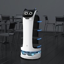
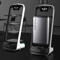
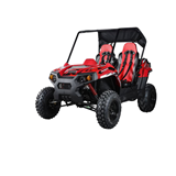
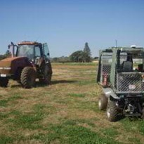
The industry of vehicle automation is much broader than commercial car automation. Freelance Robotics has worked on automation across many types of vehicles. For Instance, we have developed automation components for farming vehicles such as irrigators, tractors, and buggies, mining vehicles such as drilling rigs, and also industrial vehicles like forklifts and car crash testing vehicles. Civil engineering is an additional area of application, with successful robots having been developed for pipe inspection. In the wider context of the automated market, these applications are just a few examples. Given the potential variety and utility of applications, automated vehicles comprise a clear growth market.
GPS acquisition and processing
When the environment is an open space, automated vehicles often use GPS technology to obtain their absolute position. As the antenna is generally at a certain height and known to rock and tilt, we compensate for this difference of antenna position compared to the vehicle position on the ground using an additional sensor. This sensor is termed a Dynamic Measurement Unit (DMU) or Inertial Navigation Systems (INS) depending on the sensor output smartness. They consist of six to nine axis measurements generally composed of XYZ accelerometers, roll, pitch, yaw gyroscopes and XYZ magnetometers. A DMU commonly provides just the raw or noise filtered data, whereas INS provides a corrected output using Kalman filters to compensate for the defaults of each sensor, as some drift or have bias errors. An INS can also be loosely coupled to the GPS sensor position, velocity, and orientation data. Furthermore to improve performance the INS can be tightly coupled, merging the Doppler distance measurement from satellite triangulation with the less noisy data from INS to improve both GPS and INS accuracy. Also of interest, the Kalman filter can be used to filter the noisy heading from GPS using the heading data from the INS.
Local positioning system acquisition and processing
Another useful sensor frequently employed in vehicle automation is the Light Detection and Ranging (LIDAR) sensor. LIDAR allows distance to be mapped in the environment. This sensor operates independent from a GPS system, so can either be implemented with a GPS /INS system or by itself. Coupling LIDAR with a camera provides a powerful local positioning system. This local positioning system can be used to map the local environment and to identify landmarks. In this way, it is possible to know what is where remotely and also to locate the automated vehicle on the map. A commonly used technique to arrive at this data set is Simultaneous Localisation and Mapping (SLAM). As the name suggests, the technique corrects vehicle positioning from the LIDAR distance and map, creating shapes that can be recognized as a unique surrounding place on the map. The camera object/shape recognition may subsequently be applied as a complement to the map. The motor’s encoder sensors are often used in conjunction with LIDAR to improve accuracy. When several sensors are involved, Particle filters can be useful. This statistical filtering approach operates on the assumption that automated vehicle location can be anywhere. Sensor data is merged from independent sources to converge upon a more accurate solution. The downfall of particle filters is that it becomes increasingly power hungry as the number of particles increase. Consequently, to process this type of algorithm in real-time,a powerful computer is required. Fortunately, the necessary level of computing power that can cope with an embedded system is becoming commonly available, making this technique of sensor data processing the current tool of choice for automation systems.
Landmark assistance in local positioning systems
Another tool for automated vehicle localization is the use of landmarks. Landmarks can be natural or artificially added to the vehicle’s environment. When natural, the vehicle identifies shapes that are supposed to be there, such as trees, barriers, posts, et cetera.Typically natural landmarks can be complicated to identify, decreasing system reliability. For example, a tree can change shape, or barriers appear different from different angles. In comparison, artificial landmarks provide an easy, consistent way for the automated vehicle to identify its position. Examples of suitable artificial landmarks include reflectors, RF IDS, bar codes, lines on the ground, panels with geometric shapes and colours, lights, Wi-Fi or IR beacons. When the vehicle has effectively identified positioning via landmarks, it can update and track its position over time. In this way, reliable correction of positioning on its map becomes feasible when the vehicle is a) in motion or b) moved in a known environment.
Control of the automated vehicle
Once the automated vehicle has acquired knowledge of its position and orientation, it can use that information to drive. The vehicle will have a command in speed and bearing to move around. The initial objective is to make the automated vehicle control its motion along a specific AB line. To do so, a Proportional Integral Derivative (PID) is often used to get the distance and orientation difference. Essentially the PID compares where the automated vehicle is against where it is supposed to be. The aim is to reduce this difference to the smallest amount possible. To do so, the automated vehicle applies a theoretical model to output a command. For example, to change vehicle curvature (angle of trajectory) a command may be given to the actuators that drive the vehicle. The PID modifies this command by boosting or damping the model reaction, which considers previous, present and predicted measurement difference to desired measurement. This process allows the automated vehicle to drive toward the AB line with both minimum overshoot and the quickest line acquisition the vehicle can be managed. To optimize this line acquisition, tuning of the PID is required.
Automated vehicle path planning
Once the automated vehicle controls motion along a line, the same principle can be easily extrapolated to control from one line to another. The vehicle can thereby create a path with any desired shape that the vehicle’s model can conform to. This new line could be too small to be considered a curve; alternatively, Bezier curves may be used to create a path where curvature itself can be used to conform to a curved path. Thus, the vehicle can either follow a preregistered path entered by the user or determine its own path using decision rules.
Obstacle Avoidance
Automated vehicles are required to navigate a number of path modifications for successful independent driving. One of the path modifications an automated vehicle often has to determine by itself is when an obstacle gets on the way of the original path. An obstacle could be stationary or in a collision path if it is in motion. To avoid the obstacle, the automated vehicle needs to take into consideration the vehicle model and the environment map it has to determine the shortest way to recover the initial path considering a minimum clearance to surrounding obstacles. To do so, decision algorithms are used to split the map into a grid. Decision algorithms operate with more or less efficiency, running tree exploration solutions, for example, may assist to evaluate which is the more or less optimal path to go around the obstacle.
Conclusion
Putting all of these described blocks together leads to the construction of an automated vehicle. Automation is the outcome of a series of processes, which loop from the acquisition of environmental data to data processing, and the usage of processed data to control the vehicle. Motion control can occur according to a user predetermined or vehicle generated path by sending a command to the vehicle actuator. This loop ensures the vehicle moves in the desired direction. Motion changes environmental data, which is acquired by the sensors to restart the series of processes. Adaptation to the environment following set objectives is fundamental to robotics, as it is to life. This common behaviour brings the machine closer to biological systems, as the vehicle learns by reacting to its environment over time. It is predicted that the vehicle will become smarter, following a more complex decisional pattern and taking into account more information. In this way, an automated vehicle will be able to perform tasks of increasing complexity. Looking into the future of human-machine interaction, our vision of the machine can only evolve in tandem with machine complexity. Vehicle automation, from this viewpoint, is indeed a window into the evolution of self and technology.
-160x160-state_article-rel-cat.png)


-160x160-state_article-rel-cat.png)


-205x205.jpg)